AFRY is stepping up with Quadri and Novapoint Geosuite
The geotechnicians at AFRY are stepping up with Quadri and Novapoint GeoSuite
AFRY in Gothenburg is successfully integrating all technical areas into a unified project model. By utilizing Trimble Quadri and connecting various software programs, AFRY creates a single source of information for the project. In this article, we take a closer look at how AFRY's geotechnicians work with Quadri and their experiences of starting to work within a unified model.
It's no secret that geotechnics are crucial in all construction projects. Everything we build must be adapted to the ground conditions at the site. Is there unstable clay in the ground, how deep is it to the bedrock, what reinforcement needs are there? All these questions affect every part of a project and can be very costly both in time and money if handled incorrectly! Despite this, geotechnics are not always a natural part of the BIM process in infrastructure projects, which is somewhat surprising.
With the help of Trimble Quadri, it is easy to work integratively across different technical areas. Geotechnicians can also directly connect Novapoint GeoSuite to the Quadri model and, for example, generate soil layers and rock models directly within Quadri.
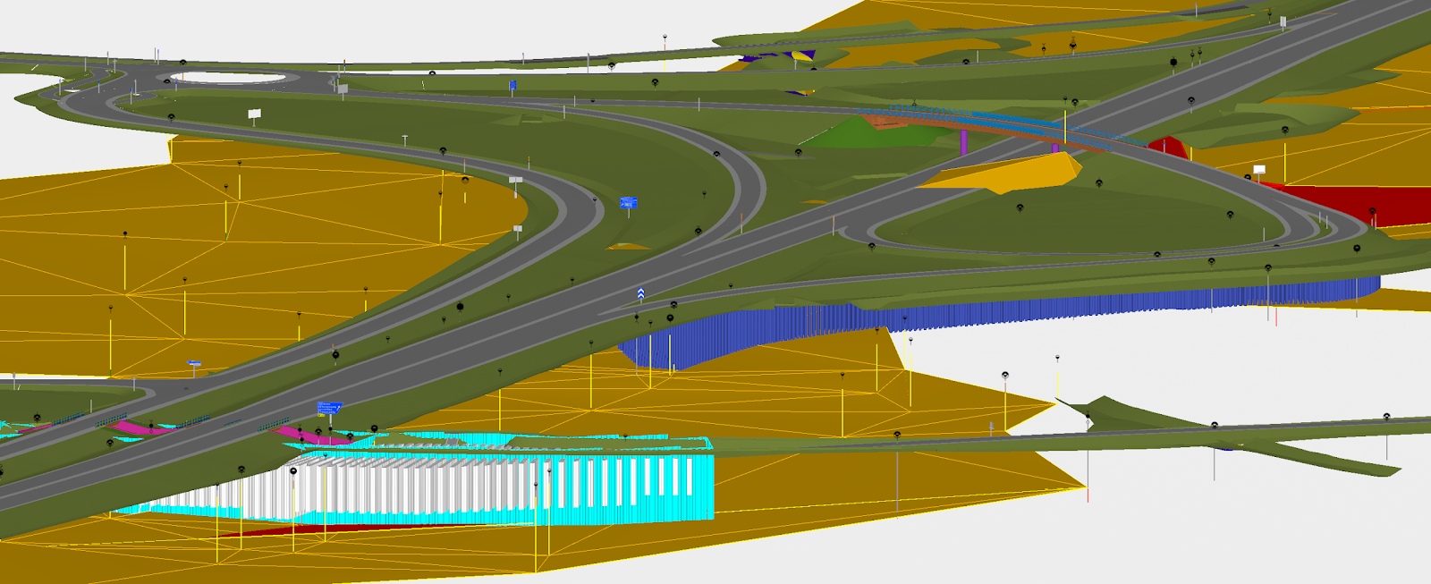
Geotechnical investigations and soil layer models in Quadri combined with designed roads and reinforcement measures. (Image: AFRY)
Some who have chosen to integrate geotechnics into the model-based workflow are AFRY in Gothenburg. To learn more about this, we spoke with Maria Margenberg, Geotechnician, and Pedram Tahmoury, BIM Coordinator.
All disciplines collaborate in real time.
The geotechnical department at AFRY in Gothenburg consists of about 20 people who work with both investigations and the design of reinforcement measures and geostructures. There is also a fully equipped geotechnical lab and a field department with 5 drilling rigs. "We work on all types of projects," says Maria. "Everything from smaller housing projects to large traffic authority projects and investigations for detailed plans."
Maria Margenberg has worked for 5 years as a geotechnician at AFRY and was educated at Chalmers in Gothenburg, which ensures good knowledge of clay. "Clay influences everything we do here in Gothenburg, not just in Gothenburg but throughout western Sweden," Maria explains. "Clay presents challenges, but it also makes working as a geotechnician particularly interesting here in Gothenburg."
As a geotechnician, one sometimes feels a bit forgotten in projects. Additionally, you are often the one who brings difficult news, such as the need for expensive foundations or geotechnical reinforcement measures, says Maria with a smile. "It's also true that as geotechnicians, we can never know everything because we work with things that aren't visible!"
Novapoint Geosuite and cad-tools
In their daily work, AFRY's geotechnicians use Novapoint Geosuite in combination with various CAD tools to make interpretations, presentations, and design reinforcement measures, among other things. "Previously, we worked more or less entirely CAD-based, and all information exchange in projects was file-based. This meant that our work to generate sections took a lot of time," continues Maria Margenberg.
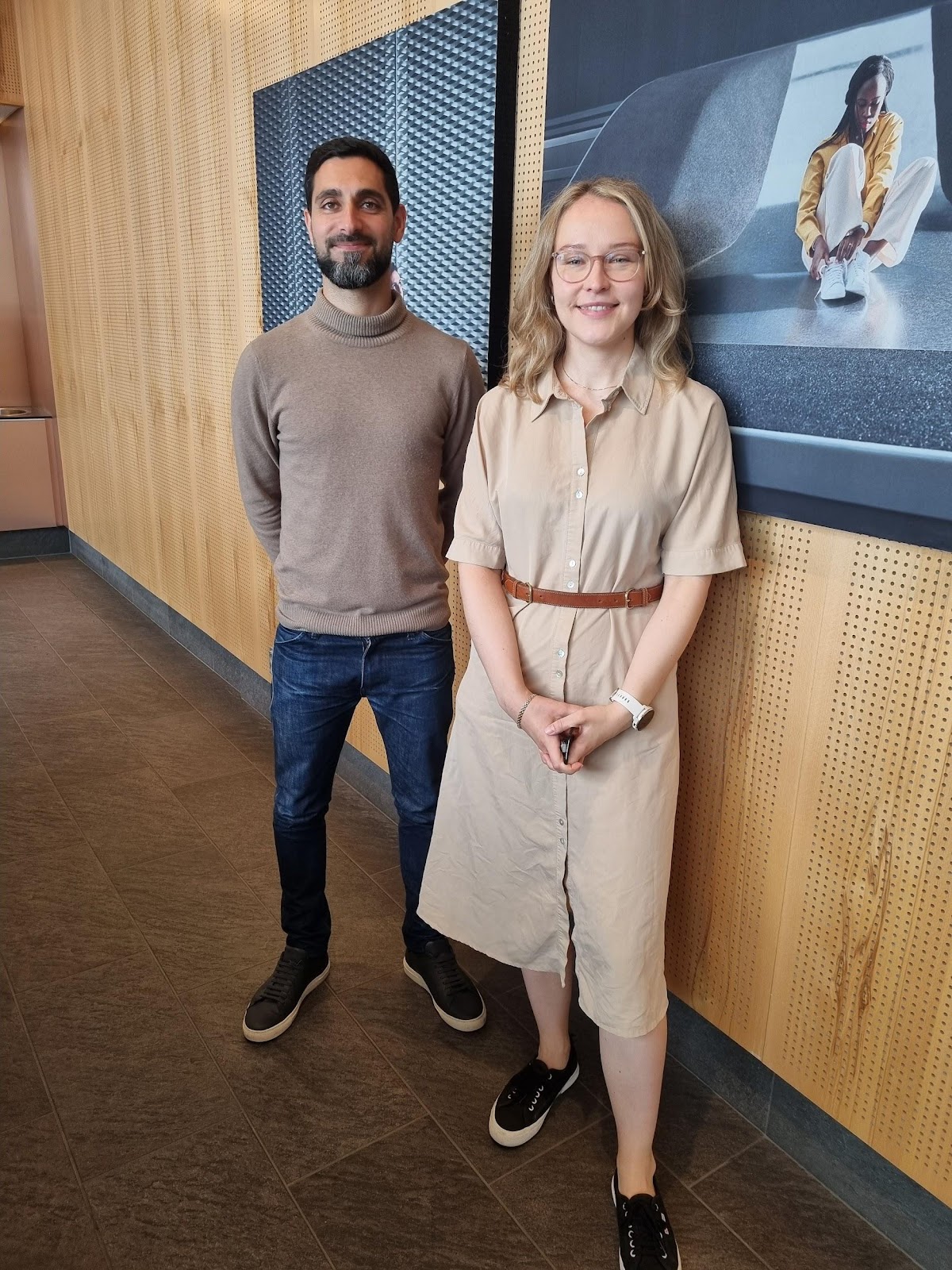
Pedram Tahmoury and Maria Magenberg (Photo: Jonas Wenner)
Pedram Tahmoury, a BIM coordinator in several large infrastructure projects, explains that they have recently been working a lot on integrating all technical fields into the BIM process, including geotechnics. "Working model-based shouldn't be something that we on the BIM department do alone; it's an issue that concerns everyone in the project," Pedram emphasizes and continues, "The geotechnics team has become very skilled at working model-based in a very short time!"
Geotechnics work directly in the model
"At AFRY, we are currently working on several large infrastructure projects in Gothenburg, both with state and municipal clients. In most projects, we use Quadri and Trimble Connect as coordination platforms in combination with a variety of design tools. There are a few technical areas that work in 2D or do not need to update very often, where we as BIM coordinators model and import their files for them. We work with a mix of connectors and traditional import/export in the Quadri model – but almost all technical areas are connected to the model directly and are responsible for updating their own parts. There are a few technical areas that work in 2D or do not need to update very often, where BIM coordinators import the files," explains Pedram. "By working this way, everyone in the project is close to the model, and it becomes an integrated part of everyone's work."
"It becomes so much easier to show what we geotechnicians are doing and concluding," continues Maria. "We include everything related to geotechnics in the models ourselves – both interpretations, boreholes, and of course, we in geo create all surface models of rock and soil that everyone else then uses as a basis. Just the fact that we can generate all our geotechnical sections and profiles and include all the data from different technical areas directly from the Quadri model saves a lot of time, and we know that the data is current and updated," says Maria Margenberg.
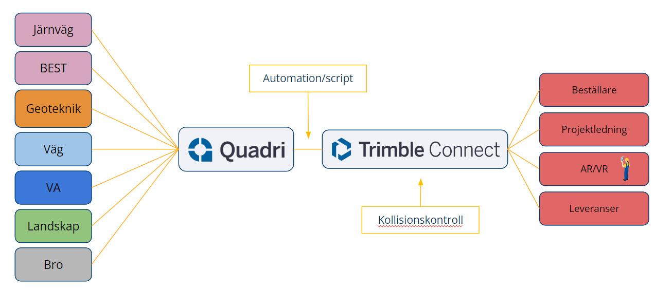
This is how AFRY works with Trimble Quadri and Trimble Connect in projects. (Illustration: Trimble)
"By having everyone use Quadri as a common platform, everyone knows they are always working with updated data," continues Pedram. "The workflow is such that everyone directly involved in design works in Quadri, either by using a connector (for example, to Revit, Tekla, or Novapoint), or by importing and exporting files. For those not directly involved, we generate rendered files daily that are available on Trimble Connect. These files are created using scripts that export selected parts of the Quadri model and place them on Trimble Connect. We also perform automated clash detection in Trimble Connect using their open API," explains Pedram Tahmoury.
Trimble Connect - simplifies communication with everyone in the project
"The rendered files on Trimble Connect are then shared with the client as a URL link. This allows the client to follow the project's progress live. When the files are updated, the link is updated as well. We can also control how long the link will be valid and which version of the files they should see," concludes Pedram.
"Everyone who is not directly working in Quadri follows the project in Trimble Connect. Internal project management does not need to wait a week for model updates; they always see the latest version entirely web-based. Connect is an incredibly good tool that is super easy for everyone to use," notes Maria Margenberg.
Maria further explains, "We also work with all geotechnical measures and reinforcements in model form. Everything from sheet piles and KC columns to lightweight fill is included in the model to clarify the connections with other technical areas. There has been a rapid development in our working methods during the five years I have worked here. Initially, we worked drawing-based and created models from the drawings if necessary. Now, we create the models first; they are the source of all information, and then we create drawings from the models," states Maria Margenberg.

"Geotechnical reinforcement measures in Quadri combined with designed roads and buildings. (Image: AFRY)
"There is really only one drawback to uploading geotechnical data into a shared 3D model," notes Maria. "Someone looking at the model might think that uncertain data is very precise just because it is in 3D. This is something we continually work on so that uncertainty becomes a part of the objects' properties."
"As a geotechnical engineer, actively working in the model together with everyone else in the project makes me feel more confident that everyone understands our challenges—and that we understand theirs! This is how everyone should work with geotechnics," concludes Maria Margenberg.
If you want to learn more about how to get started working in Quadri as a geotechnical engineer, contact us at Trimble!
AFRY
AFRY is one of Europe's leading companies in engineering, design, and advisory services.
AFRY supports its clients in making sustainable advancements in the infrastructure, industrial, and energy sectors.
AFRY combines deep specialist knowledge with technological innovation to offer solutions that increase efficiency and sustainability.
19,000 employees in 40 countries. In Sweden, AFRY has 84 offices spread across the entire country.
Quadri
Quadri is a BIM platform developed by Trimble. It is used by engineers, architects, and project managers to create, manage, and share 3D models and project data throughout the entire project lifecycle. Quadri offers a collaborative environment that allows teams to work together in real-time, improving efficiency and reducing the risk of errors.
Some of the key features of Quadri include:
Real-time collaboration:
Users can work simultaneously on the same model, facilitating communication and coordination.
Integration with other tools:
Quadri can be integrated with several other design and construction tools, facilitating data exchange and workflows.
3D visualization:
The platform supports advanced 3D visualization, helping users better understand and analyze project data.
Project management:
Quadri offers tools for efficiently managing project data, versions, and documentation.
https://quadrihelp.trimble.com/Quadri-Help-Home
Novapoint GeoSuite
Novapoint GeoSuite is a set of tools designed for managing geological data, geotechnical investigations, and the design of reinforcement measures. Novapoint GeoSuite offers features for managing soil and rock data, performing advanced calculations, and generating detailed reports and visualizations.
https://novapointhelp.trimble.com/Geosuite
Quadri Connectors
Quadri Connectors enable efficient data exchange and collaboration between different software and systems within infrastructure projects. Quadri Connectors act as bridges to transfer and synchronize data between Quadri and various design and coordination tools. Quadri Connectors are included in the Quadri Business Premium license and are available for Revit, Civil3D, Open Roads Designer, Novapoint, Tekla, Grasshopper, ProjectWise, Trimble Connect, Trimble Business Center, among others. By integrating different systems via Connectors, project information can be seamlessly shared and managed in real-time, enhancing collaboration, efficiency, and accuracy throughout the project.